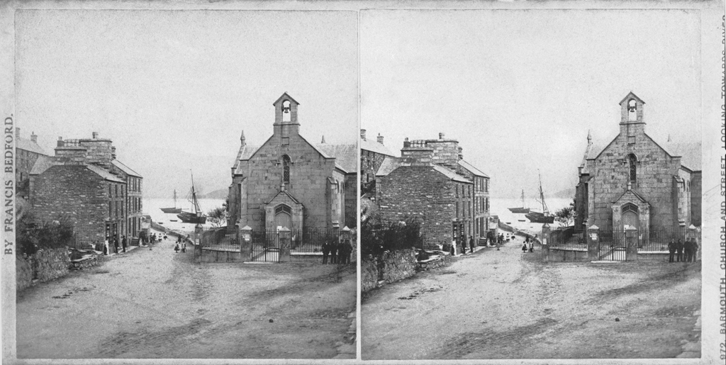
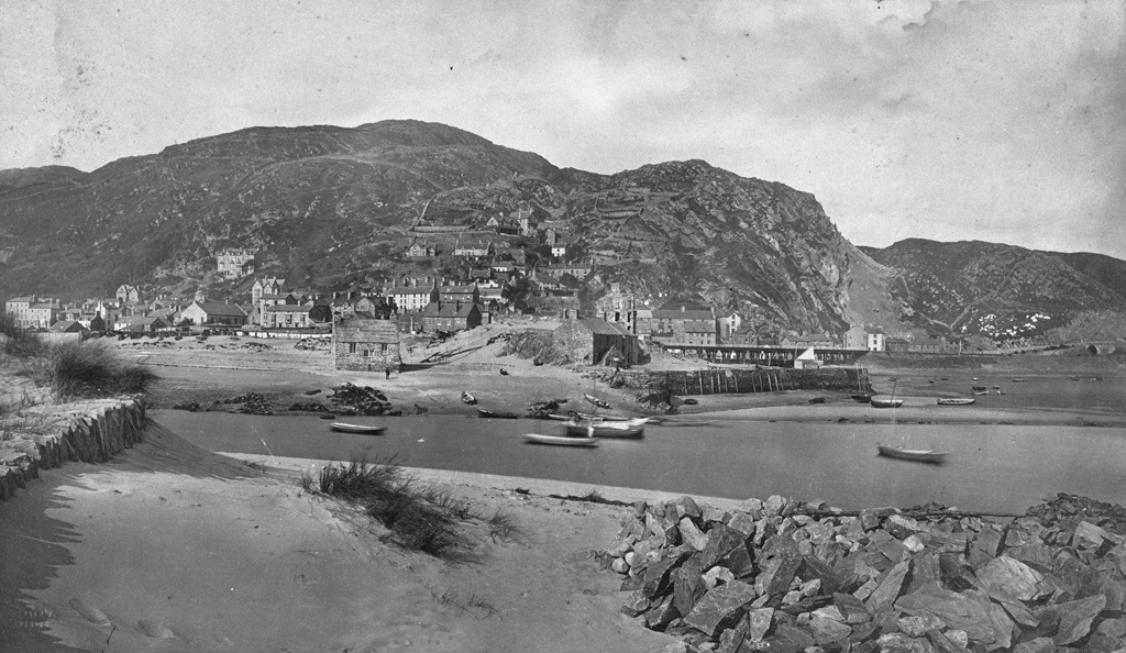
Barmouth
Barmouth - Overview
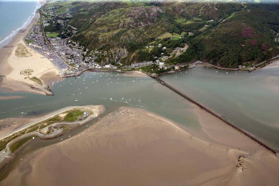
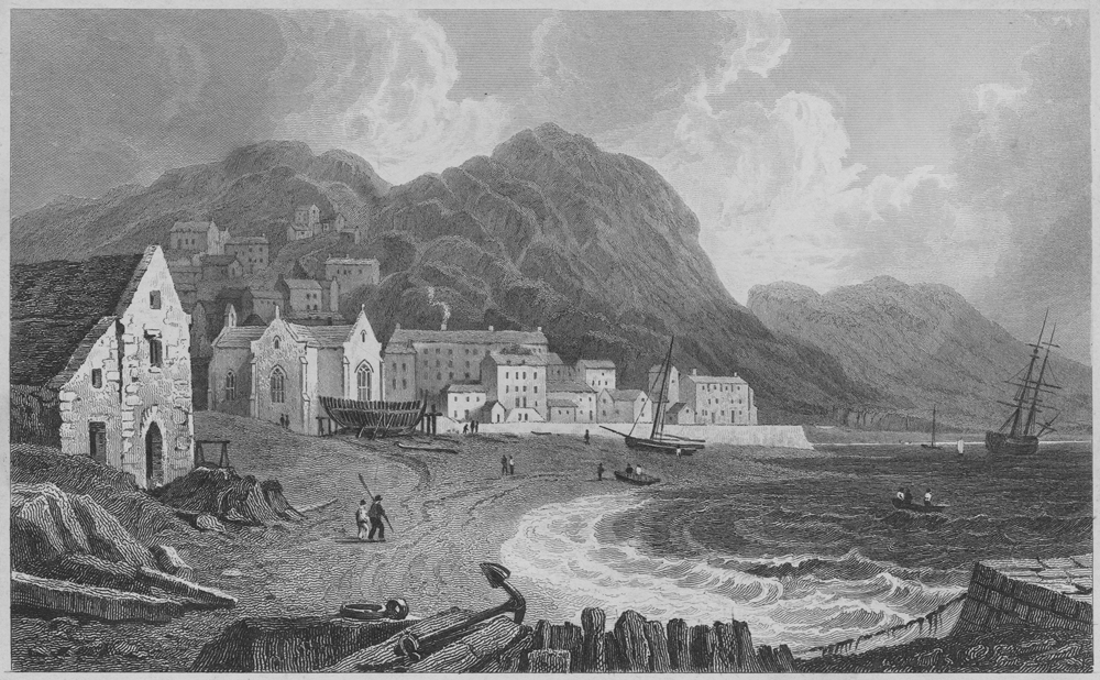
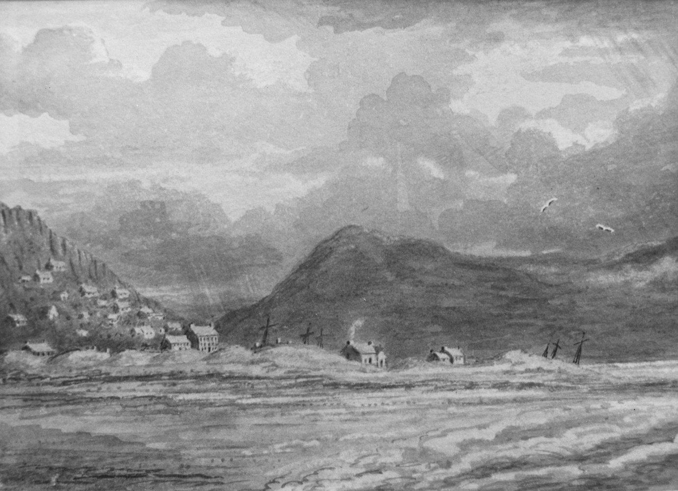
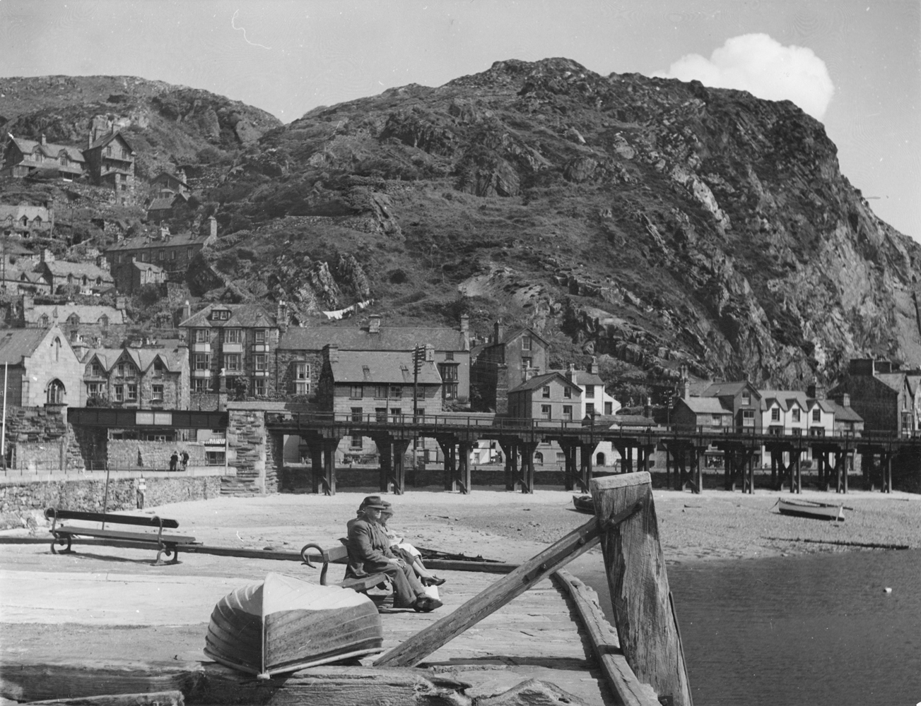
As the town name indicates, Barmouth (in Welsh Abermaw) is located on the estuary of the river Mawddach. First recorded as a settlement of four houses in a survey of 1565, little is known about the town prior to the eighteenth century. As coastal shipping increased in the late eighteenth century, Barmouth developed as a ship building centre, with a harbour supporting fishing and the export of wool from the Merioneth sheep farms. Despite the picturesque surroundings, the infrastructure for sea bathing developed only in the first half of the nineteenth century.
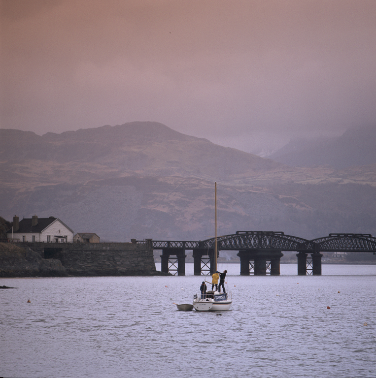
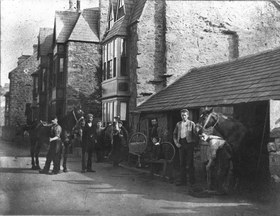
With the arrival first of the Great Western Railway from Shrewsbury, and later the Aberystwyth and Welsh Coast Railway from the south, more and more tourists began to arrive, making it necessary for the town to expand. Owing to the close proximity of the sheer cliffs to the coast line, the new guest houses were built on rising terraces against the rocks and amused tourists frequently commented that it was possible to look into the chimneys of the houses in the streets below. In contrast to other popular seaside towns in Wales, Barmouth never developed an overtly resort architecture, but retained its appeal as a place visited for the simple and picturesque experience.
During one particularly enchanting walk along the beach in moonlight in the 1880s, the German holidaymaker Johann Jakob Honegger witnessed an extremely rare sighting of milky seas in the northern hemisphere.
Accounts of Travel
"Aus dem Berglande von Wales", c. 1900
Sophie Döhner (1844 – 1933)
Auf langer Brücke überschreitet die Bahn die Mawdach, die aus dem Gebirge kommt und hier einem großen, von Bergen umrahmten See gleicht, und dann sind wir in Barmouth. Es ist dies auch ein sehr besuchter Badeort, der herrliche Spaziergänge am Strande sowohl wie hoch über dem Flußbett in die Berge hinein bietet, deren höchster, der Cader Idris, mit seinem viergipfeligen, langgestreckten Rücken die anderen alle überragt. Gerade in dem halbverschleierten, schweren Regenton des Abends, den nur an einelnen Stellen gelbrote Lichtstreifen der undergehenden Sonne durchbrachen, war der Blick so großartig schön von diesem Panorama, daß ich ganz begeistert war.
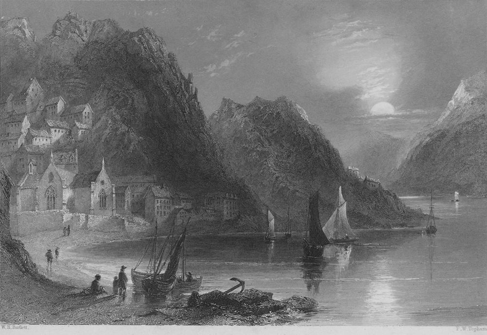
The train crosses the River Mawddach over a long bridge. The river flows from the highlands and here looks more like a lake surrounded by mountains, and we finally arrive in Barmouth. This place, too, is a very much frequented seaside resort which offers wonderful walks along the beach as well as over the mountains high above the river bed; the highest crag, Cader Idris, towers over all the others with its four-peaked, elongated ridge. The half-veiled, heavy colours of an evening rain, with only a few of the yellow-red beams of the setting sun breaking through, produced such a magnificent panoramic prospect that I was entirely enchanted.
"Skizzen aus England. II.", 1883
Johann Jakob Honegger (1825 – 1896)
Das war eine zauberhafte Augustnacht; strahlend im Vollmondschein lag der Strand, als wäre lichter Tag über ihn ausgegossen. Die Flut war im Steigen; eine Woge um die andere rauschte heran, geschwätzig, plaudernd, und eine um die andere riß mehr Land an sich. In regelrechten Curven rückten sie vor, schnitten sich ein, leckten an unseren Füßen, ein kühler Willkomm, trieben uns rückwärts Schritt um Schritt. Wir gingen im feinen losen Sande auf und ab, unermüdlich, träumend, pholosophirend, in unsaussprechlicher Stimmung. Lange schon hatte die Geisterstunde geschlagen. Hoch klopfte das Leben in unsern Pulsen, beschwingt über Zeit und Raum hinweg. Das sind die Momente, da die großen Gedanken und hohen Gefühle erwachen uns sich von der Seele losreißen, die unter ihrer Wucht vibrirt. Vom weichen Licht überströmt, lag unabsehbar das Meer vor uns; und weit draußen, von einer Sandbank aus, die hügelartig in seine Fläche sich hineinstreckte, stieg allmählich ein gelblich-grüner Streifen auf; das Meer begann zu leuchten wie in flimmernden Diamanten. Auch dieses seltene und seltsame Phänomen schenkte uns der Himmel, als wollte er in die wenigen glücklichen Stunden alles zusammendrängen, was er an Licht und Schönheit zu geben hat. Weit hinten in der Tiefe stiegen einzelne Segel auf und nieder, geisterhaft. Aus dem prachtvollen Waldthale hinter uns wälzte sich in trüben Wellen langsam und schwer über die Sandebene, der Flut entgegenkämpfend, die Maw.
It was an enchanting night in August; the beach lay glistening under the moonlight as if bright day had been poured over it. The tide was rising; one wave after another rushed towards us, gossiping and chatting, and one after another seized more land. They came forth in perfect curves, cutting inland, licking our feet in cool welcome, driving us backwards step by step. We walked up and down over the fine, loose sand, untiring, dreaming, philosophising, we were in an indescribable mood. The witching hour had struck some time ago. The pulse of life was pounding in our veins, triumphing over time and space. These are the moments when great thoughts and exalted sensations awaken in us and break free from a soul that quivers under their magnificence. Bathed in soft light, the infinite sea lay in front of us, and from a sandbank in the far distance a green and yellow band rose gradually from the deep. The sea began to glitter like a sparkling diamond. This rare and curious phenomenon was a gift from heaven, as if it wanted to cram everything it had to offer in light and beauty into these few hours. Far, far in the distance, lonely sails rose up and fell down, ghostlike. Emerging from the grand wooded valley behind us, the Maw writhed in cloudy waves slowly and laboriously across the sandy plain, struggling towards the tide.
"Sommerbilder aus England und Wales", 1889
Friedrich Althaus (1829 – 1897)
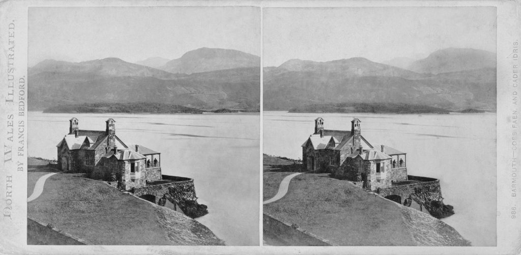
So oft man diese Bergstocktouristen sah, so dachte man unwillkürlich an den Cader Idris, den fast dreitausend Fruß hohen höchsten Berg der Umgegend von Barmouth und, nächst dem Snowdon, dem angesehensten Berge von Wales. Der Cader Idris ist für Barmouth, was der Vesuv für Neapel. Wer nach Barmouth kommt, hat entweder schon von dem Cader Idris gehört oder er kann nicht umhin, wenistens aus der Ferne seine Bekanntschaft zu machen; denn stolz und einsam hebt er im Südosten der Mawdach-Bucht über allen anderen Bergzügen seinen langgestrechten Kamm, seine schroffe Felswand, seinen wildgezacken Doppelgipfel empor. Die Aussicht von seiner Höhe gilt für die großartigste in Wales. Man erblickt, so versichern die Eingebornen, an einem hellen Tage von dort oben das ganze Wales, nach England hinein und über das Meer nach Irland hinüber. Eine Besteigung des Cader Idris nimmt daher unter den Plänen vieler Barmouth-Besucher eine hohe Stelle ein. Das Unternehmen scheint leicht genug. Der Berg ist so nahe, nicht weiter als etwa sieben englische Meilen. Und überdieß ist der öffentliche Ausrufer von Barmouth da, der mit dieser Würde zugleich das Amt eines Eselvermiethers und Führers nach dem Cader verbindet und nicht geneigt ist, die Schwierigkeiten der Besteigung zu überschätzen. Auch die Reisehandbücher entflammen durch romantische Schilderungen die Unternehmungslust des Touristen.
Der Cader Idris hat seine Seen und Sagen. In uralten Zeiten, so berichtet die wälsche Legende, war er der Sitz des großen Astronomen Idris, der von dort oben die Sterne beobachtete, dessen Felsensitz noch auf dem Gipfel gezeigt wird und dem der Berg in Wahrheit seinen Namen Cader, d. H. Sitz des Idris, verdankt. Der unternehmungslustige Tourist kann so vielen Lockungen nicht widerstehen. Und wenn er eines schönen Abends den sagenhaften Berg mit prächtigen Umrissen und Farben in den heiteren Himmel emporsteigen sieht, nimmt er sich vor, ohne Verzug den folgenden Morgen für die Bergfahrt zu benützen.
Whenever the alpenstock tourists came into view, one was involuntarily reminded of Cader Idris, the nearly 3,000 foot high mountain in the Barmouth area and, besides Snowdon, the most famous peak of Wales. Cader Idris is to Barmouth what the Vesuvius is to Naples. Whoever comes to Barmouth has either heard of Cader Idris or cannot fail to make its acquaintance at least from a distance, to the south-east of the Mawddach estuary, as it lifts its long ridge, its rough rock face, its wild, rugged twin peak proudly and singly above all the other mountain ranges. The prospect from the summit is said to be the grandest in all of Wales. The locals say that on a clear day, one can see the whole of Wales, parts of England and Ireland across the sea. Climbing Cader Idris therefore takes top priority among many visitors of Barmouth. The undertaking appears simple enough. The mountain is nearby, no more than seven English miles away. And besides, there is the Barmouth town crier, who combines his honourable office with his role as donkey hirer and guide to Cader and is not inclined to make too much of the difficulties of the ascent. With their romantic descriptions, the travel guides, too, kindle the tourists’ spirited flames of adventure.
Cader is blessed with lakes and legends. An old Welsh tale relates how in ancient times, the mountain once was the seat of the great astronomer Idris, who used to gaze at the stars up there and whose rocky seat is still to be seen on the summit and who gave the mountain its name Cader, i.e. Seat. The enterprising tourist cannot withstand so many temptations. On a beautiful evening, beholding the grand silhouette of the legendary peak rise in many colours into the bright sky, he vows without delay to undertake the ascent the very next morning.